| MLS# 50119454 |
Request more Information about this listing from: | 1 Superior Way Ontonagon, MI 49953 Price: $3,600,000  72 Acres Waterbody: Lake Superior | Type: Vacant Land Area: Ontonagon (66015) Ontonagon County | ||
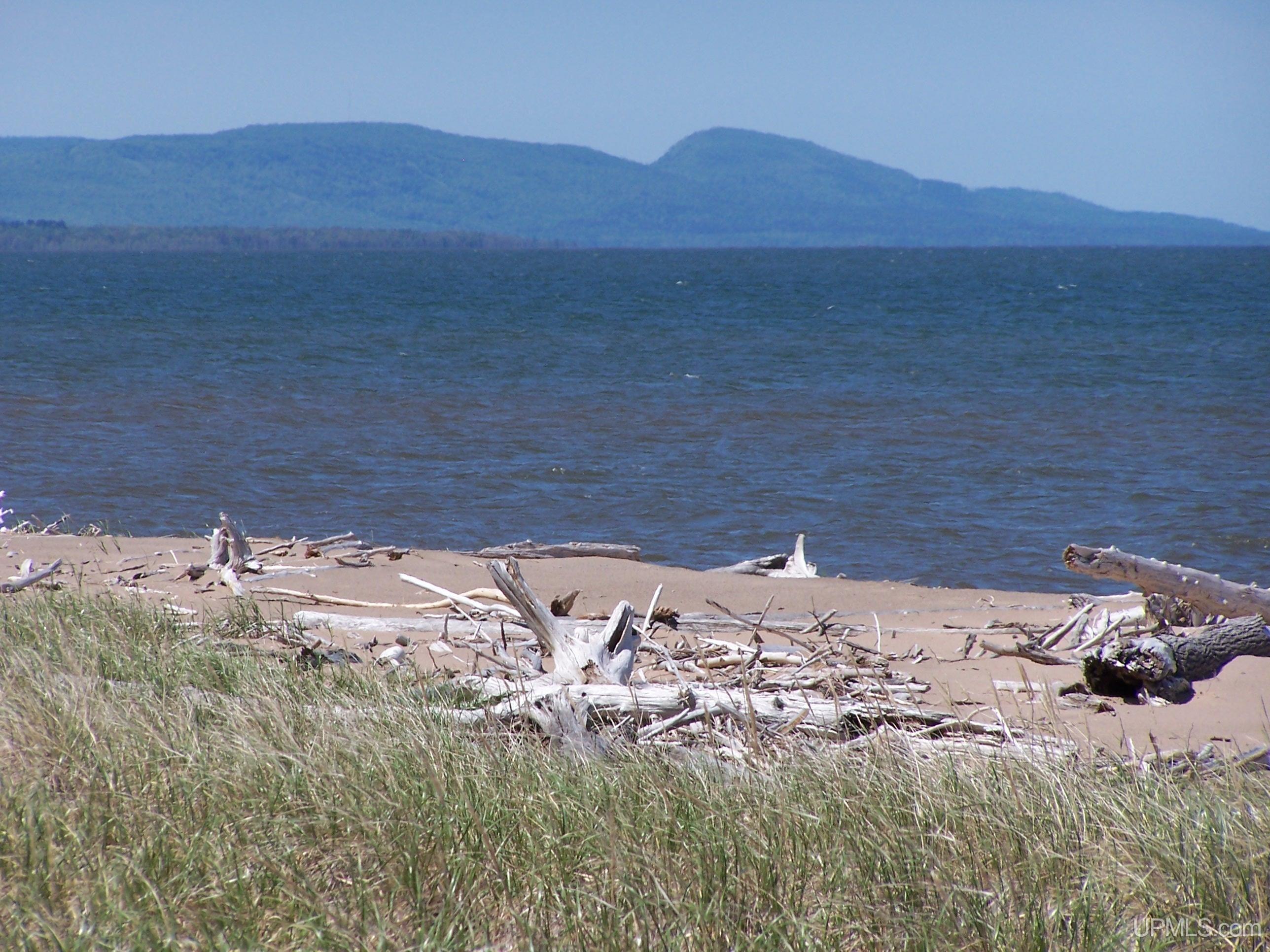
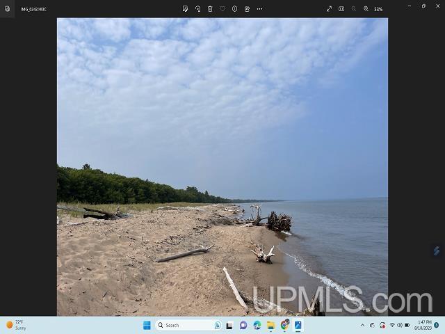
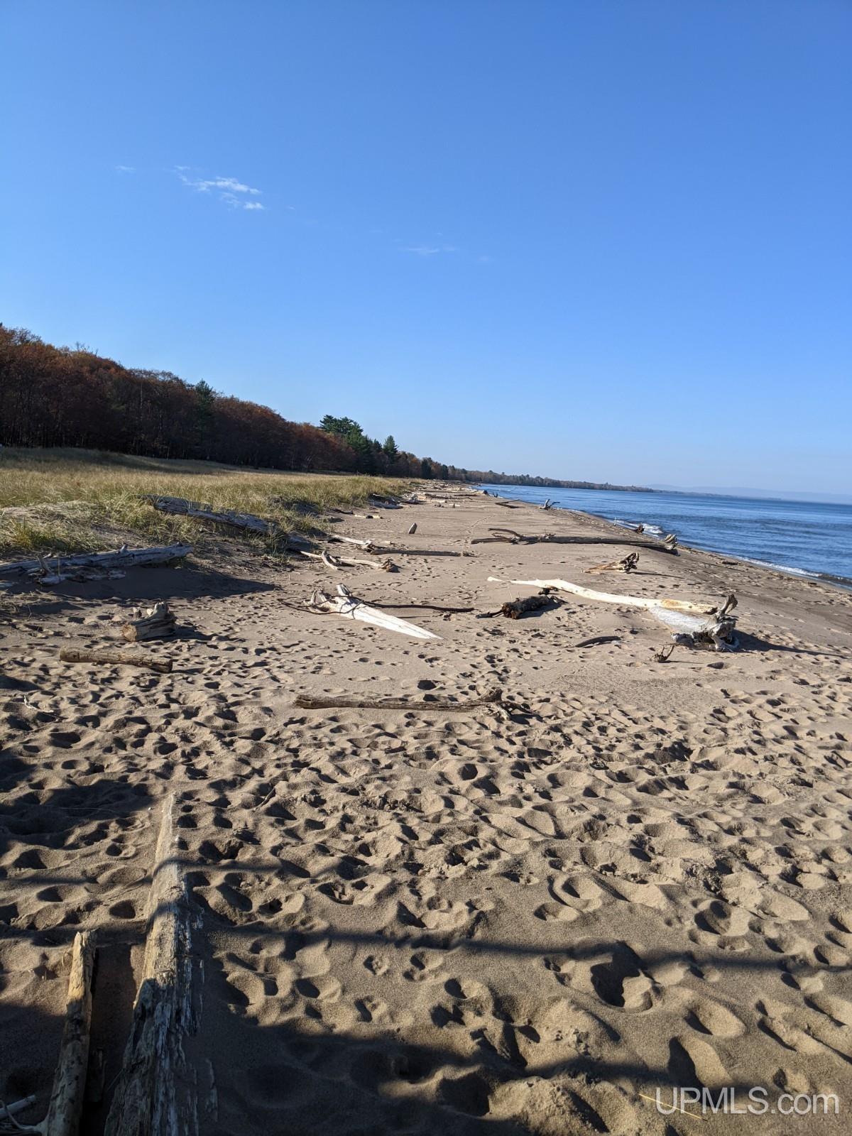
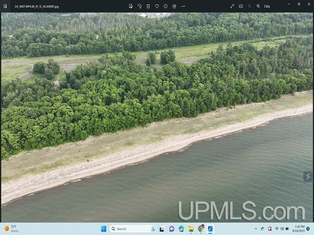
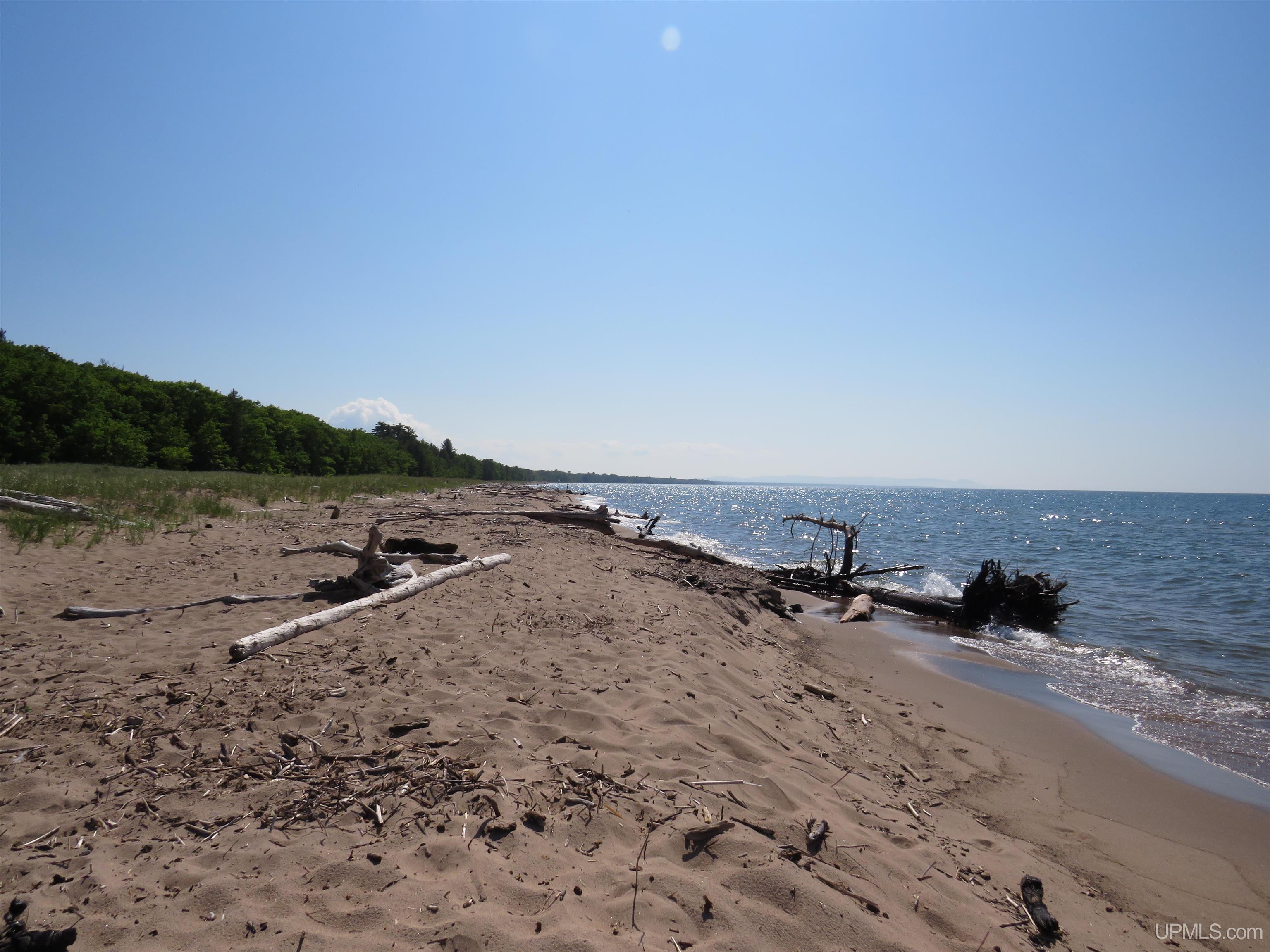
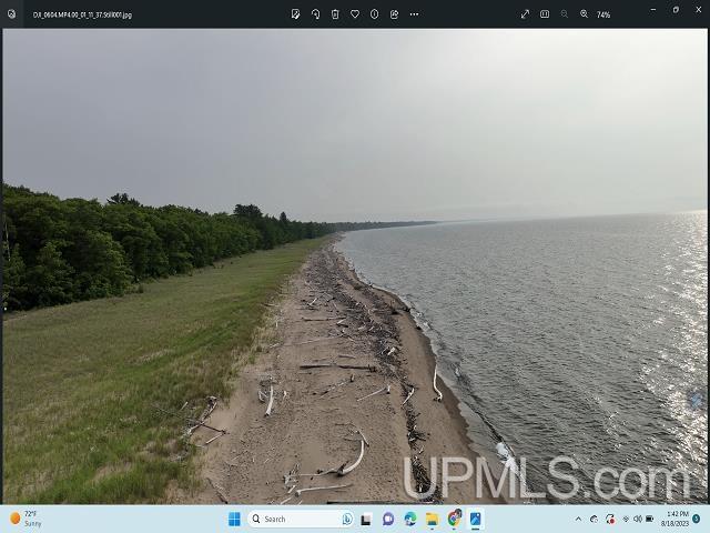
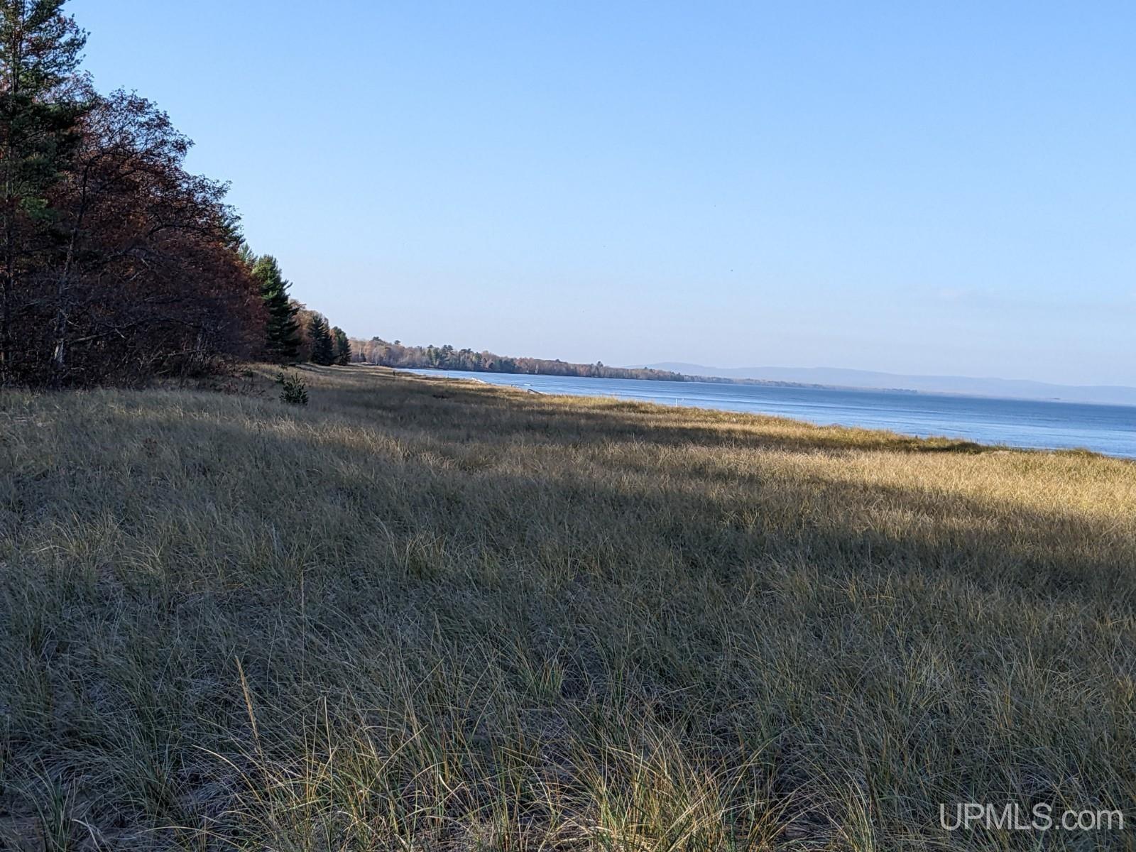
| Directions: Remarks: THE FIRST TIME ON THE REAL ESTATE MARKET - “THE LOST BOWL” – a 3,800 foot stretch of stunning sugar sand beach nestled along the shore of Lake Superior, on a 72+/- Acre Parcel - is being offered for sale. One of the best properties on the Great Lakes! It is located in the Village and township of Ontonagon along with the county of Ontonagon, which is located on the south shore of Lake Superior, in the western part of the Upper Peninsula of Michigan. - Ontonagon (pronounced ON-t?-NAH-g?n) is named after the Ontonagon River. There are three popular thoughts as to how this name was derived. One, an early 1672 French Jesuit map identified the river with the name Nantounagon – derived from an Ojibwe language word noojitoon ziibi, meaning “hunting river”. Another theory claims is was named by the native Chippewa after the bowl-like shape of the mouth of the Ontonagon River where it drains in Lake Superior, in their time already a transportation center for early voyagers, missionaries, and explorers. A more delightful legend about the name was told in 1836 to missionary Reverend Frederick Baraga(who journeyed along Lake Superior for 35 years). An Ontonagon settler of Chippewa descent shared that it meant “the place of the bowl”. When a child, his mother told him that many years past, a young girl dropped her wooded bowl in the river and it floated away. She ran along the bank crying “On-tonagon, on-tonagon!”. Which meant “I have lost my bowl!”. - This area has years of history. Copper prospectors arrived in the late seventeenth century. Copper mining started here in 1845 with a boom period until 1870. Silver was mined in the period from 1873 to 1876. Lumbering (for pine, then hardwood and hemlock) played an important part in the economic development of the area from 1880 to 1900. Today, the County has become known for tourism-related business development. - A Video of this Property is Available at https://youtu.be/kN0gzUTetrI ... Continued In Addendum Addendum: ... is visited by over 600,000 visitors each year, and is located just 15 miles to the west. Also located in the Park is Lake of the Clouds, one of the most photographed sites in the Upper Peninsula. The Park has endless miles of hiking and cross country ski trails along with downhill skiing and snowshoeing. - The Ottawa National Forest, Lake Gogebic (the U.P.s largest inland lake) numerous water falls, and over 1,200 miles of streams and rivers are located in this County. - Located next to The Lost Bowl is access to miles of ATV Trails (www.mitrale.org) and hundreds of miles of groomed snowmobile trails that runs in the area – this trail system interconnects with 2,500 miles of U.P. snowmobile trails, and with Wisconsin’s northern trail system. - Views of the crystal clear waters stretch outward for miles. You can glimpse the Porkies to the west and to the east are The Ontonagon Light House, the river and the Marina, which is within walking distance... See Associated Documents | ||||
| This Listing Provided Courtesy Of: GREAT LAKES & LAND OF MARQUETTE, INC. | ||||
View Map: | Click Here to view map of area | |||
| Back |
|
UPAR MLS idx site design by Carrie's Creations |